About this project
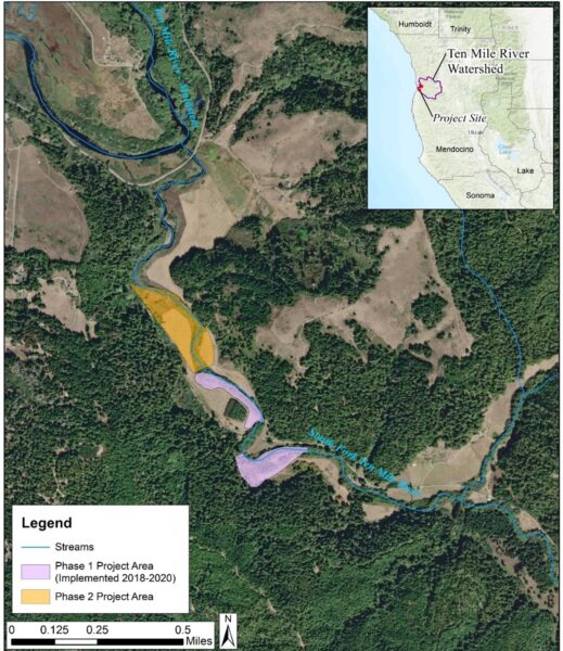
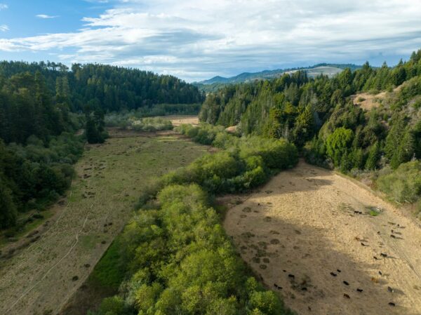
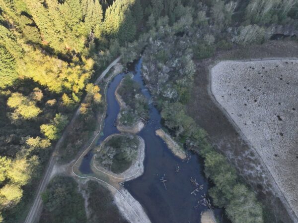
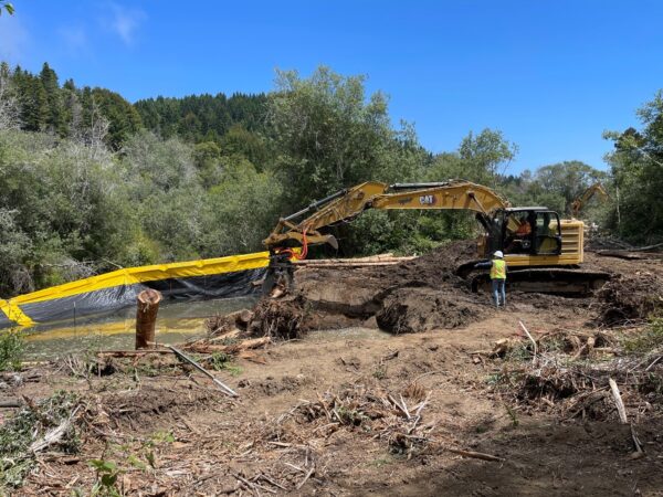
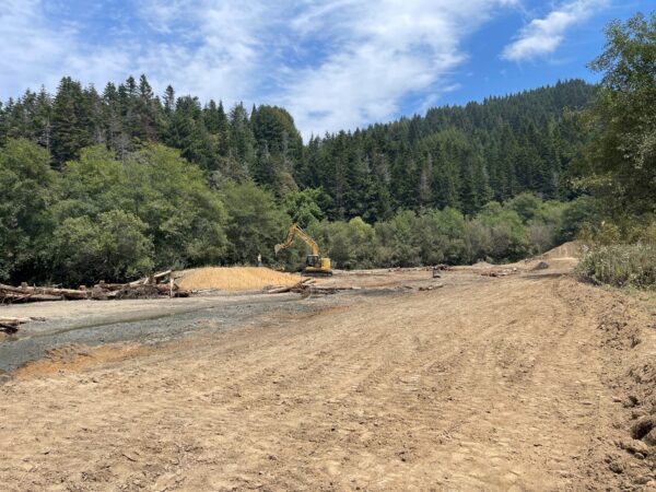
This Project is part of The Nature Conservancy’s (TNC) Lower Ten Mile River Habitat Enhancement Program, which is an ongoing effort to systematically restore critical habitat for endangered coho salmon in the lower Ten Mile River watershed in coastal Mendocino County. The Project is located very low on the South Fork Ten Mile River, within the area of daily tidal influence, on a private ranch over which TNC holds a conservation easement. The goal of this Project is to increase the production and survival of juvenile coho salmon by creating high quality instream habitat and restoring floodplain function within this highly aggraded river valley. Design and permitting for the Project began in 2022 with funding from CDFW and construction was completed in summer 2024 with funding from NOAA and the State Coastal Conservancy. TNC worked with a team that included PCI Ecological (engineering design and permitting) and Wylatti Resource Management (construction contractor) to complete the Project.
Connection to Previous Work on the South Fork Ten Mile
This project extends downstream from two previous restoration sites that TNC implemented in 2018 and 2020. These projects, known as the South Fork Ten Mile River Habitat Enhancement Phase 1A and Phase 1B projects, were designed to provide a suite of complex habitat elements that are beneficial to coho across a range of flow conditions and to reestablish channel meandering and floodplain connection by supporting natural geomorphic processes. Both of these previous projects were permitted using small habitat restoration permitting pathways and were therefore designed to fit within the size restrictions of those permits (500 linear feet of stream and 5 total acres).
Phase 1A was constructed in 2018 and included construction of multiple large wood structures; an off-channel, seasonally flooded wetland; and a split-flow side channel with additional large wood structures across a 0.5-mile reach.
Phase 1B was constructed in 2020 and included a flooded wetland and adjacent engineered log structures; accelerated recruitment log structures; and a 135-meter side channel.
Phase 2 Habitat Enhancements
Building on these previous phases, this Project includes the following habitat enhancements immediately downstream of the Phase 1 improvements:
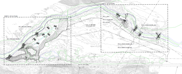
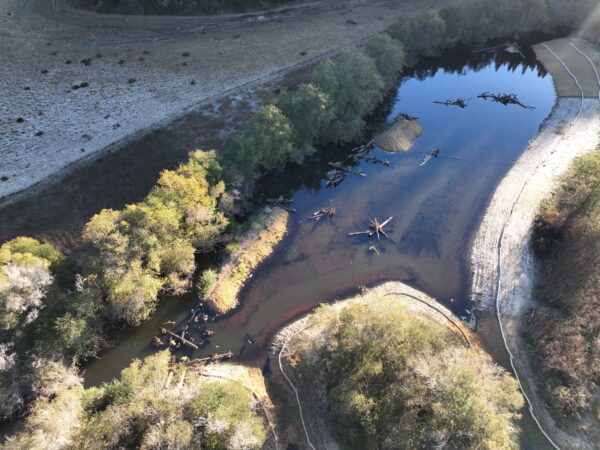
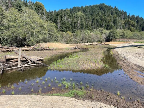
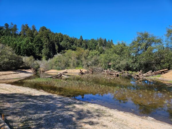
1) A long, deep alcove and shallow pond and associated large wood structures were constructed to connect an existing seasonal pond and valley wall wetland complex which previously only connected to the main channel during a five-year or higher flood peak;
2) A dry, rarely flooded gravel deposit on the left bank was excavated to create a 1.6-acre flooded wetland. The wetland surface will flood daily during high tides and during nearly every storm event;
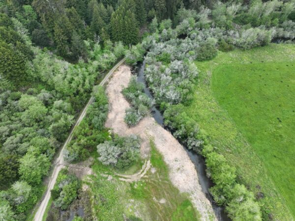
3) A small alcove and large wood structure set into a wide, tree-covered gravel bench was constructed to provide complex, low-velocity, off-channel winter habitat in the upper project reach; and
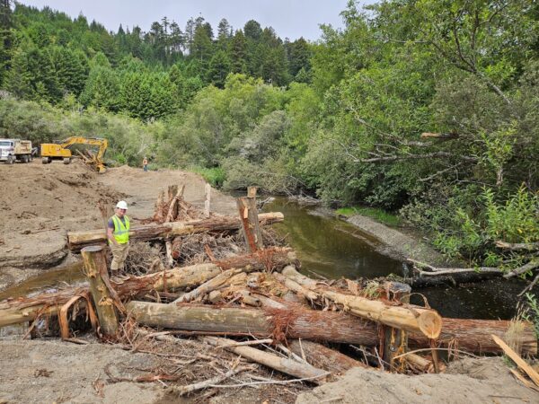
4) Four accelerated recruitment-type large wood structures were constructed to increase channel bedform and habitat complexity in the long glide reach. A mix of downed alder, willow slash, and whole redwood trees were used to form the structures.
Adaptive Management at Phase 1
The Project also includes implementation of adaptive management measures at two locations in the Phase 1 project area.
First, the depth of the inlet at the Phase 1A off-channel, seasonally flooded wetland was adjusted to inundate more frequently at lower winter baseflow conditions. PIT tag antenna monitoring data showed that it was difficult for salmonids to access the site during drought winters. The inlet was deepened about three feet to increase utilization of the feature across a wider range of potential future climatic conditions. Second, monitoring indicated that pilot channels in the previously constructed Phase 1B alcove would better facilitate salmonid access to the upper elevations of the alcove during winter storms. Construction crews excavated this network of pilot channels during implementation of the Project. Bundling adaptive management of these previous project sites into the permitting for construction of this current Project proved to be an efficient and effective way to implement lessons learned from monitoring the previous sites.
Project Partners
- California Department of Fish and Wildlife (CDFW)
- National Oceanic and Atmospheric Administration (NOAA)
- State Coastal Conservancy
- North Coast Regional Water Quality Control Board
- PCI Ecological
Permitting Tips
Permitting in the coastal zone poses unique challenges when evaluating tradeoffs in Environmentally Sensitive Habitat Areas (ESHAs). These salmonid habitat enhancement and restoration activities require removal of riparian vegetation and other temporary impacts to existing habitat for a variety of species, including special status-species. Permitting with the Coastal Commission, using the NOAA/Coastal Commission Federal Consistency Determination, required careful consideration and evaluation of the loss or change of one ESHA (Riparian Corridor/Riparian Forest) to improve conditions within another ESHA (Anadromous Fish Stream and Wetlands). Providing an assessment of the trade-offs for the Coastal Commission staff using the agency’s specific language was key. It facilitates communication and eases the burden on agency staff to make the findings necessary to authorize the project. And it can be another valuable method for describing the multiple benefits of a project.
“The programmatic biological opinions from both the USFWS and NOAA Fisheries plus the State Water Board General Order and PEIR provided a thorough list of avoidance measures needed to implement the South Fork Ten Mile Project. Having a set of protection measures for restoration activities that are agreed upon by the permitting agencies allowed my team to quickly identify the measures needed for the Project. The regulatory tools provide a clear pathway to understand the pre-construction survey and reporting needs, construction-period oversight and avoidance measure requirements, and post-construction monitoring and reporting. It saves time and allows more funds to go towards implementation of great restoration work.” Carrie Lukacic, Principal Environmental Planner PCI Ecological
“The more efficient and less size-limited permitting pathways that have been made available through the Cutting the Green Tape initiative have allowed us to implement bigger, more ambitious restoration projects on a faster timeline than ever before. This Project went from concept to construction in just two years, and our restoration design was able to focus on maximizing ecological benefits at the site without having to narrow things down to meet permit-driven size limitations.” Peter Van De Burgt, North Coast Restoration Project Manager, TNC
Proponent
Status
The project was implemented in summer 2024.
Type of project
- Large wood augmentation
- Off-channel and side-channel habitat
- Tidal, subtidal, and freshwater wetlands
County or Counties
- Mendocino
Watershed
Ten Mile River
Project size
The total project area is approximately 4.94 acres and 1,470 linear feet. The Project will result in the restoration of 2.83 acres and 2,973 linear feet of riparian, floodplain, and instream habitat.
Project documents
- Basis of Design Report
- Notice of Exemption under CEQA Categorical Exemption 15333 - Small Habitat Restoration Projects
- Notice of Applicability for Coverage under the Water Board Statewide Restoration General Order (SRGO)
Permitting pathways used
- CEQA Categorical Exemption 15333 – Small Habitat Restoration Projects
- USACE Nationwide Permit 27 – Aquatic Habitat Restoration
- Water Board Statewide Restoration General Order (SRGO)
- USFWS Statewide Restoration Programmatic Biological Opinion (PBO)
- Central Coast NMFS Programmatic Biological Opinion (PBO)
- North and Central Coast Federal Consistency Determination (CD) – Coastal Commission and NOAA Restoration Center
- CDFW Restoration Consistency Determination (CD)
- NOAA Restoration Center Programmatic Environmental Impact Statement (EIS)
- CDFW Lake and Streambed Alteration Agreement
- Section 106 concurrence from the State Historic Preservation Office
- Coastal Jurisdiction Consolidation (request to County to consolidate Coastal Zone permitting with the California Coastal Commission)

