About this project
Project Location
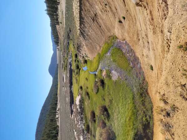
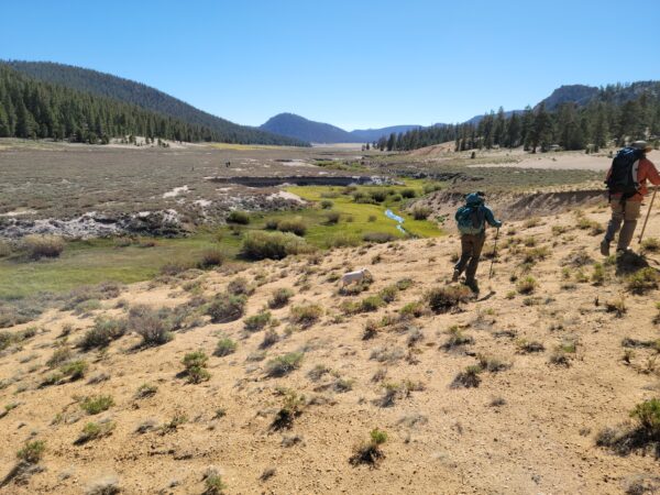
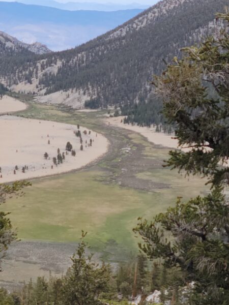
This project includes 13 meadow sites located on the Kern Plateau region of the Inyo National Forest in the Mount Whitney Ranger District, in Inyo and Tulare counties. Ten meadow sites are in tributary headwaters to the Kern/South Fork of the Kern River. The three remaining meadow sites are in tributary headwaters of the Owens River. All but four meadow sites are within the designated Golden Trout Wilderness Area.
Project Partners
The project is a Trout Unlimited and U.S. Forest Service initiative working in partnership with the Inyo National Forest, California Department of Fish and Wildlife, and other restoration professionals and partner organizations, including Point Blue Conservation Science, Anabranch Solutions, Waterways Consulting, and the Sierra Meadows Partnership.
Project Description
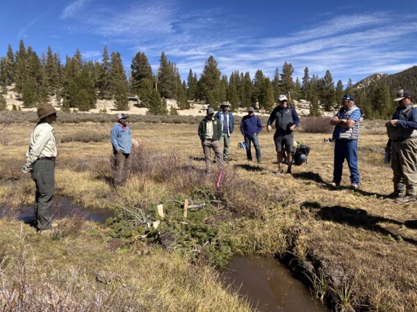
The purpose of this project is to restore 13 degraded headwater stream-meadow complexes utilizing low-tech process-based restoration (LTPBR) techniques as defined by Wheaton et al. 2019. The LTPBR design relies on strategic hand-built placement of biogenic habitat structures of the following types:
(1) postless and post-assisted beaver dam analogs (BDAs)
(2) post-assisted log structures (PALS), and
(3) sod (sedge) plugs
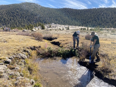
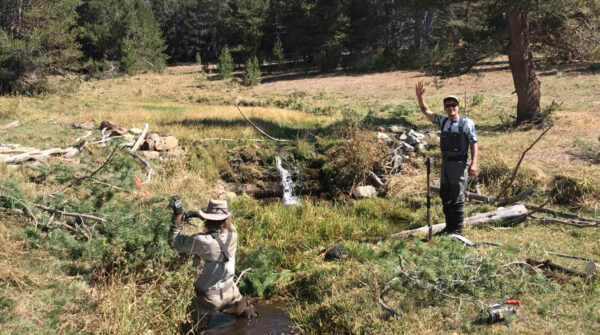
Across the 13 project meadows approximately 1,993 biogenic structural treatments will be placed instream (across 17 miles of stream). All structures will be built by hand using hand tools (saws, loppers, sledgehammers, etc) and utilize local natural materials (conifer, sagebrush, willow). Structures will scale to the size of the channel width and depth, but will generally be 1 – 3 ft tall, 5 – 15 ft wide (laterally, bank to bank), and an average of 3.2 ft in depth (longitudinally, upstream-downstream).
This project utilizes entirely low-tech process-based restoration techniques, with only hand crews and hand tools. Only non-mechanized hand tools can be used in project site meadows within wilderness area designation (e.g., hand saws, loppers, knives, shovels, sledgehammers, etc). In non-wilderness designated areas, hand-held mechanized equipment can be used, including, chainsaws and hand-held gas-powered pile drivers. No machinery is proposed.
Most of the project meadows are within designated wilderness area where access will be walk-in only, with potential use of pack mules for equipment and gear. Non-wilderness area meadow sites will be accessed using pre-existing designated Forest Service routes, where parking will occur in existing designated areas, and walk-in access will then be achieved. Considering the project is 100% hand-built using hand tools, there are no defined staging areas.
The biogenic structures are grouped by design as “complexes,” which can be defined as a series of structures working in symphony within a geomorphic stream reach to meet a specifically defined objective (e.g., headcut mitigation, channel aggradation, lateral connectivity enhancement).
The structures will be made largely of locally sourced native vegetation, resident streambed and bank soil/cobble, and wooden posts. The locally sourced vegetation (in order of use preference) includes:
(1) conifers (that have encroached the meadow floodplain due to the degraded unnaturally dry conditions),
(2) sagebrush (that are in overabundance due to the degraded unnaturally dry condition), and
(3) willow.
Of the three structure types, BDAs and sod plugs incorporate non-vegetative fill (i.e., native soil) to stabilize vegetative fill material and impinge water flow. This material includes soil/cobble/rock that will be sourced immediately upstream of the location of structure installation (as these areas will become inundated with water upon installation). In some instances, BDAs and PALS will incorporate the use of wooden posts. These will either be made onsite with native branch material or purchased and brought onsite. Posts will be driven in by sledgehammers and handheld pile drivers in wilderness areas, and handheld gas-powered pile drivers may be used in non-wilderness areas.
No dewatering is proposed during construction, though construction will occur when stream flow is at its nadir. At each meadow site, the downstream most structure will be placed first as to capture suspended sediments and reduce downstream effects of temporary increased turbidity that may occur during construction.
Read more about this project in the Trout Unlimited blog post Working together for the gold: Meadow restoration in Golden Trout country, by Jessica Strickland.
Project Benefits
- Improved and expanded mountain wet meadow habitat
- Reduced peak flows and increased/extended summer baseflows
- Enhanced aquatic habitat for California Golden Trout (Oncorhynchus mykiss aguabonita) and mountain yellow-legged frog – northern California DPS (Rana muscosa) and terrestrial habitat for meadow-associated species such as migratory birds
- Improved water quality
- Increase groundwater storage
- Increased plant biomass above and below ground, increased soil organic matter, and thereby improved soil capacity to sequester Greenhouse Gases (GHGs) from the atmosphere.
- Improved stream and meadow condition would improve visitor experience on public lands thus leading to increased back-county guiding, pack-guiding and fishing guiding, in addition to supporting local businesses/tourism operations
Permitting Tip for Similar Projects
Early agency consultation and pre-application meetings and coordination. This can streamline your application package preparation through a shared agency-applicant understanding of project-specific nuance and individual regulator expectations.
Thank you to Jessica Strickland, Trout Unlimited’s California Inland Trout Program Director, for providing information about this project and photos.
Proponent
Status
Planned for implementation during the summer field season in 2023 through 2026.
Type of project
- Beaver dam analogue
- Mountain meadow and stream habitat restoration
County or Counties
- Inyo
- Tulare
Watershed
Kern River and Owens River tributary headwaters
Project size
826 acres of instream and riparian habitat restoration and approximately 2,500 acres of enhanced meadow habitat. 32 stream miles restored.
Project documents
- Notice of Applicability (NOA) for the Statewide Restoration General Order (SRGO)
- NOA Attachments: Project Maps, Receiving Waters Information,
- Project Overview Map
- Final Project Design
- Horseshoe - Round Meadow Restoration Pilot Project 2-pager
Permitting pathways used
- USACE Nationwide Permit 27 – Aquatic Habitat Restoration
- CEQA Programmatic EIR for the State Water Resources Control Board Statewide Restoration General Order (SRGO PEIR)
- Water Board Statewide Restoration General Order (SRGO)
This project received an individual project biological opinion for mountain yellow-legged frog – northern California DPS (Rana muscosa). A Lake and Streambed Alteration Agreement (LSAA) from the California Department of Fish and Wildlife was not required because the project is on federal land.

