About this project
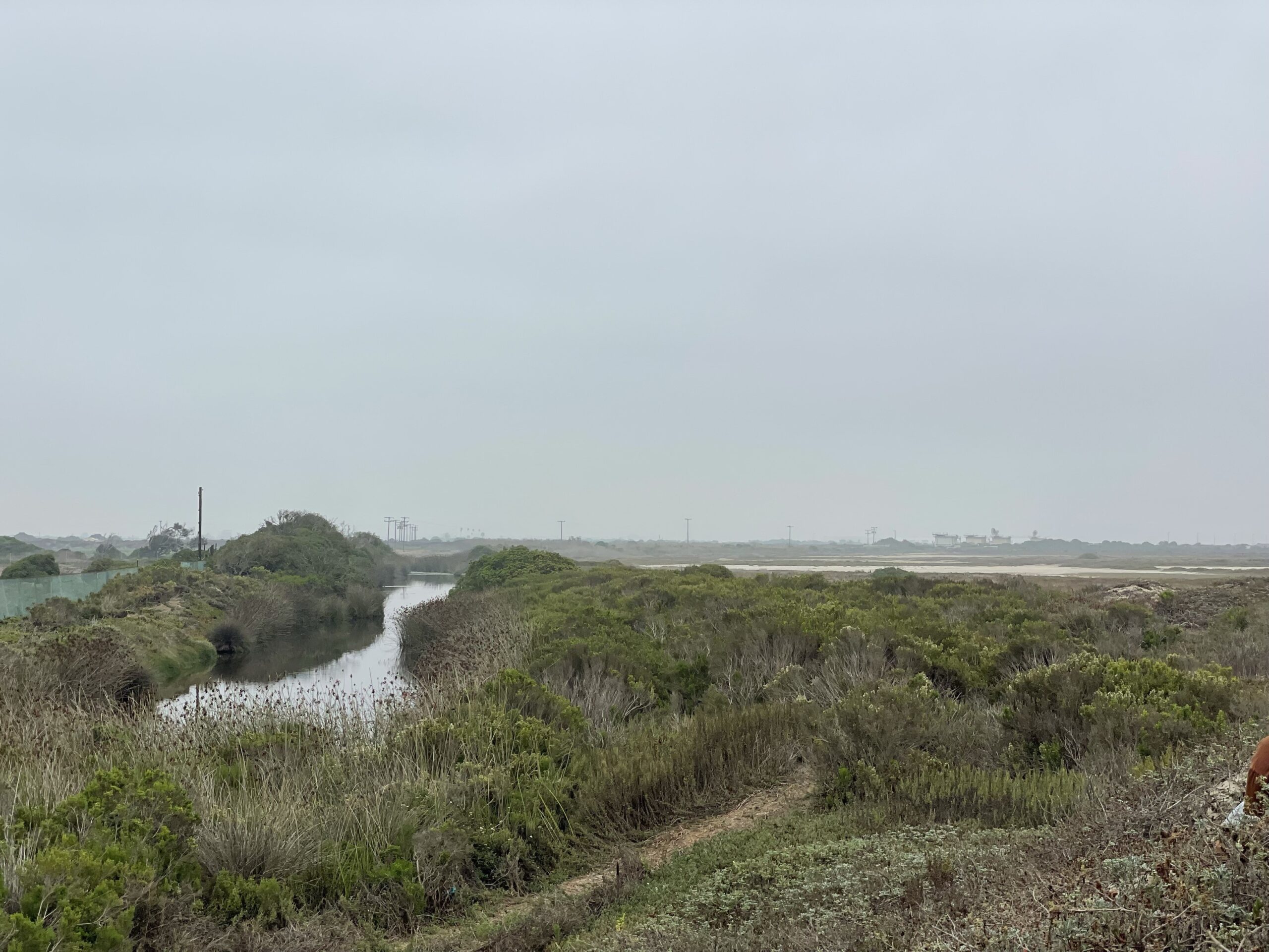
Project Location
The project is located within the City of Oxnard, along a section of the coast extending from Port Hueneme south to the northwestern boundary of Point Mugu Naval Air Station. The Project area includes several parcels owned and managed by the State Coastal Conservancy, The Nature Conservancy, and the City of Oxnard.
Project Partners
California State Coastal Conservancy, The Nature Conservancy, and the City of Oxnard
Species Benefited
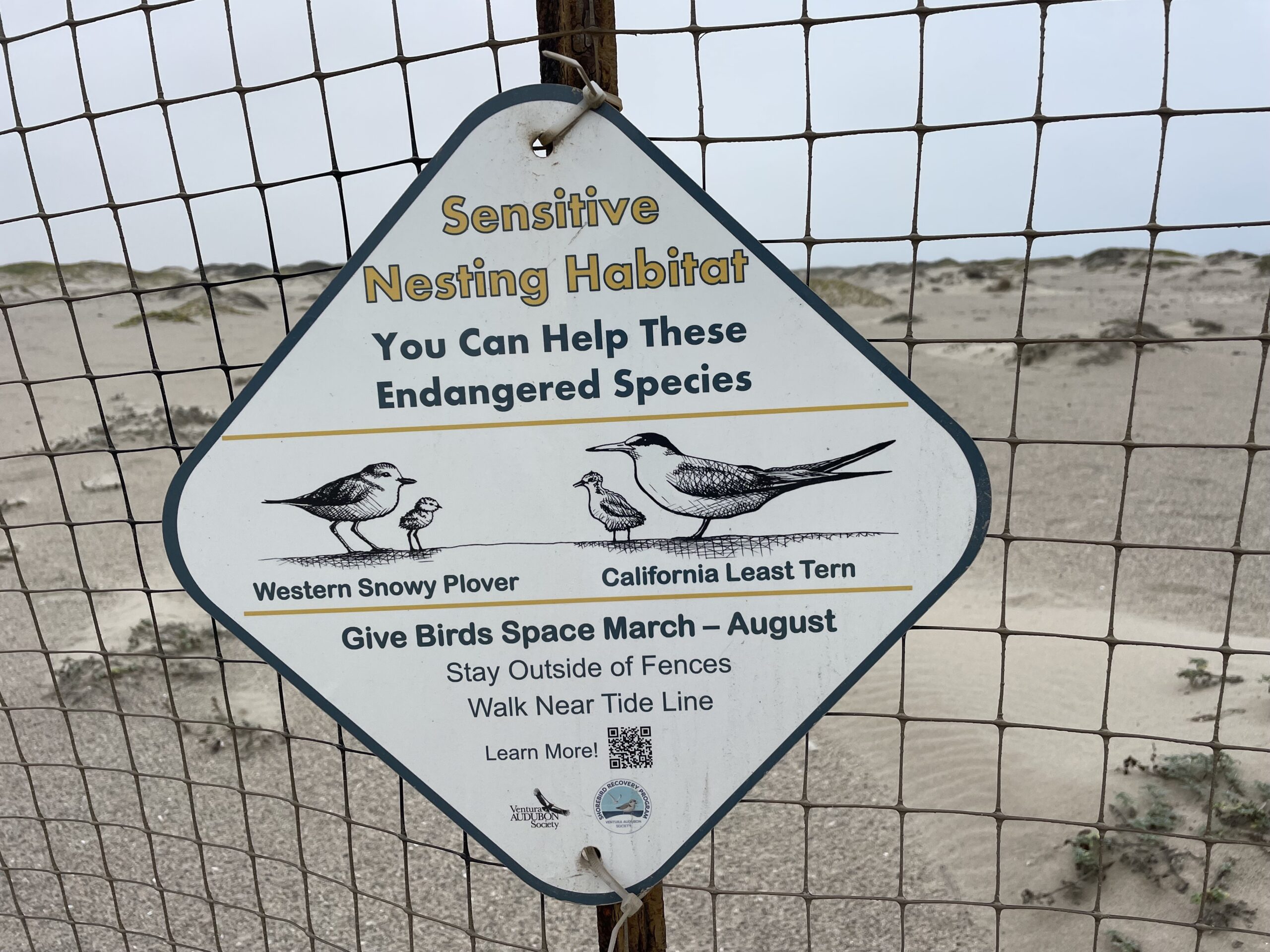
- California least tern (Sternula antillarum browni)
- western snowy plover (Chardadrius nivosus nivosus)
- Belding’s savannah sparrow (Passerculus sanwichensis beldingi)
- light-footed Ridgway’s rail (Rallus obsoletus levipes)
- tidewater goby (Eucyclogobius newberryi)
- salt marsh bird’s beak (Chloropyron maritimum spp. maritimum).
Project Goals
The Project goals are to improve habitat and hydrologic connectivity, restore ecosystem function, create diverse microhabitats, remove invasive and non-native plants, restore native plant communities, and enhance ground water recharge.
Project Description
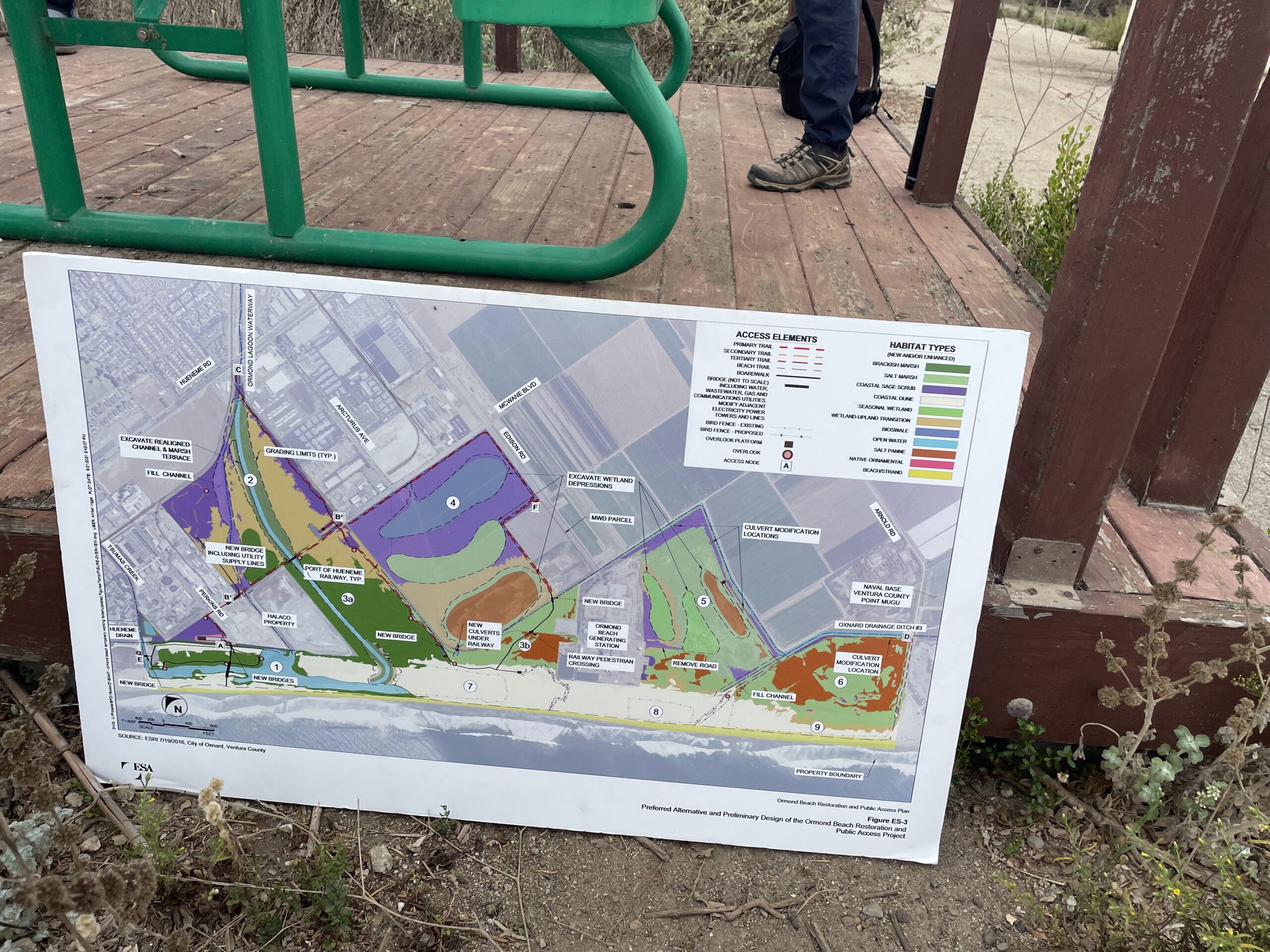
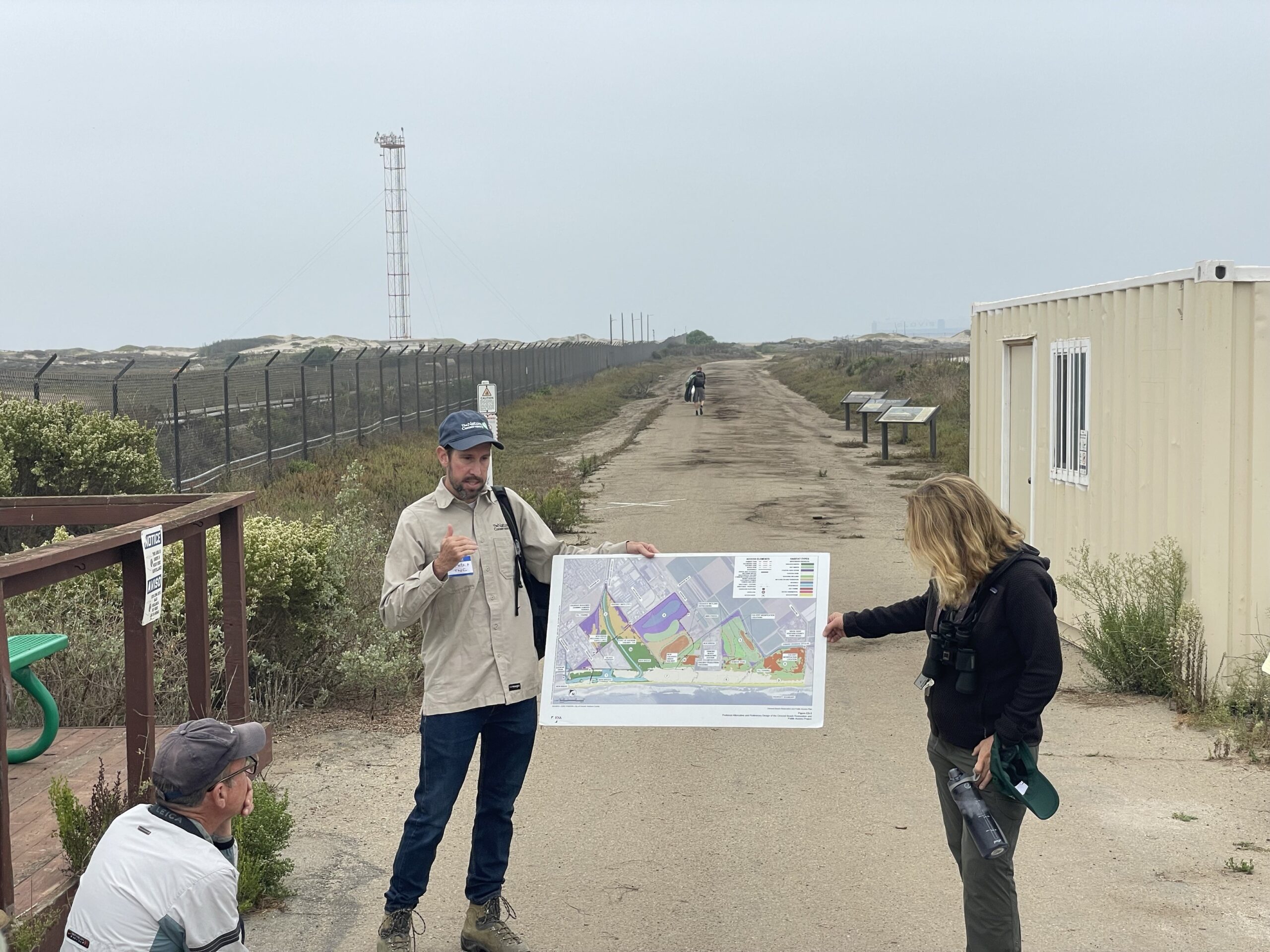
The Project will enhance or restore approximately 650 acres by creating a greater diversity of wetland habitats, expanding brackish salt marsh and upland habitat, and removing or modifying berms and channels to improve connectivity. Dune habitat will be selectively excavated, and upland habitat will be restored to help support wetland migration upslope in response to sea level rise.
Improvements to Public Access Management
Sensitive biological resources are currently being impacted by largely unmanaged public access. Therefore, the Project includes improvements to public access management that will better support habitat restoration, manage access near sensitive habitats, and reduce disturbance to sensitive species.
These new features will include boardwalks, bridges, overlooks, staging areas, and interpretive signage. Trails will be designed to protect, support, and maintain larger intact habitat areas. Overlooks will be designed to reduce disturbance to sensitive species and habitats, including the use of bird blinds where necessary. Perimeter fencing, education outreach kiosks, and other access control measures will be included at trailheads. Bicycle usage will be limited to designated paths, and bike racks and lockers will be installed to limit disturbance to sensitive habitats. Protective fencing for California least tern and western snowy plover will be installed to prevent and reduce ongoing human and vehicle intrusion in sensitive nesting habitats.
Coordination with security and local and state law enforcement will be incorporated into the Project to protect sensitive habitats and species. Enforcement activities will include ensuring adherence with the City of Oxnard’s leash ordinance and responding to canine disturbance and illegal vehicular trespass in the Project area.
Ormond Lagoon Habitat Enhancement
The Ormond lagoon will be maintained and expanded to incorporate additional brackish marsh and transitional upland habitat. The Ormond Lagoon Waterway will be re-routed, reducing nuisance flooding, restoring natural hydrologic function, and providing emergent wetland habitat. Salt marsh and salt panne habitat will be maintained and expanded, and seasonal wetland basins will be added at higher project site elevations. This includes excavation of basins with a range of hydrology and habitat to improve hydraulic connectivity. Fill from this work will be used to create upland and wetland-upland transition habitat.
Sensitive Species Monitoring
Following the initial restoration work, sensitive species monitoring will continue on-site to benefit California least tern and western snowy plover. The data collected will inform recovery metrics, land management decisions, coastal planning, and support protection and outreach programs. The Project will coordinate with California Department of Fish and Wildlife (CDFW) and United States Fish and Wildlife Service (USFWS) staff to ensure recovery efforts are continued and to help address issues encountered in the Project area that result in the disturbance of sensitive species recovery.
Tribal Engagement
In March 2022, the Lead Agency corresponded about the Project with local Tribal representatives from the Barbareno-Ventureno Band of Mission Indians, the Coastal Band of Chumash Nation, and the Santa Ynez Band of Chumash Indians. Future Tribal engagement will include additional meetings, focus groups, and field trips.
Interested Party Coordination
Outreach and community engagement for the Project has been conducted over the past six years, including community workshops, door-to-door- surveys, and public field trips. The Project will continue to incorporate public input through noticed meetings, communication via public media, involvement of focus groups, field trips, volunteer naturalist trainings, and beach cleanup events.
Proponent
State Coastal Conservancy
Status
Planning. Start date: January 2025 Completion date: December 2050
Type of project
- Tidal, subtidal, and freshwater wetlands
County or Counties
- Ventura
Watershed
Calleguas Creek
Project size
Approximately 650 acres
Project documents
Permitting pathways used
Permits are in the process of being acquired.
Project photos